Does walking the Pennine Way look hard to you? Well why not sponsor me here.
As much as possible I have tried to avoid the weather forecast, after all it wouldn’t make any difference – we’d still have to head out – but at the weekend I did see a forecast in the Daily Mail which suggested that Manchester would have thunderstorms on Thursday. I was very glad to see that this didn’t happen.

The host at the Old House explained a “short cut” which would allow us to avoid going down about 20m before coming back up and we attempted to follow his instructions. This was a mistake. Later it would transpire that his instructions were sound but having thus far only followed our little blue line on the SatNav it seems we had lost any ability to live with out it. In frustration at one point I stormed off through the tussocks and fell over fortunately I did not twist my ankle (it would have been galling to fail on the very last day!) and we eventually made our way to the path.
The mist was probably the thickest we have had (even thicker than that which hid the Stooley Pike Monument) and there were no identifying features to be seen from the top of the hill. Climbing up towards the Snake Pass was difficult and the path was surprisingly difficult to find in places. At the top of the first peak we stopped for a brief lunch break and even with the GPS we managed to set off in the wrong direction! When we eventually found our way back to the path (which involved crossing the same stream at least twice) it was as a portion of flags were ending (which was greatly disheartening).
The American couple which we had met last night were planning to walk back from Edale and if they were to make it to Torside we would have expected to meet them somewhere around the Snake Pass though they were Alas no where to be seen. Once over the Snake Pass there began a beautiful path of flags which must be the longest single stretch that we have walked these last 19 days. It probably also represented the single greatest distance we ever covered in an hour some 2.8 miles.
The end of flags presented a reasonable time to have lunch even though it was at the foot of quite a steep hill. From a distance of about a quarter mile we saw a large party that were clearly out for the day on an organised walk who scrambled down the hill we were soon to travel and then stopped for their own lunch. I’m quite sure I saw one of them nipping round a hillock for a ‘wild one’ but of course from such a distance it was impossible to tell. I am certainly glad to have avoided the need for such activity and having deliberately chosen not to have a curry last night felt confident that I would avoid the need all the way to the end.
Scrambling up the hill was a bit tricky but as this was the last real climb of the walk it seemed to go by without too much difficult and once at the top dad had “remembered” that there was a “good path”. He was completely mistaken. While it wasn’t boggy there was no really discernible path and there were lots of quite big stones which made the going slow and cumbersome.
As we approached the waterfall below (which had some how created quite a large gouge in the rock) we did meet the American couple from last night. We recommended that they come off at the Snake Pass as if they carried on to Torside they would not make it until very late on in the day and would not be hugely enjoyable. They’d had some trouble with the mist (unsurprisingly). From where we met them, however, they were about to enter an area with some phone signal and the hosts at The Old House seem happy to come and pick one up from the Snake Pass so I am sure they got home safely.

I’m not totally convinced that the ridge we were walking on was anything other than dead flat but we did eventually make it to a place that the Ordnance Survey had satisfied themselves was an appropriate place for building a trig point and it seemed like a good place to break for our final second lunch. I am certainly going to miss second lunch once I return to Normalcy.
|
|
|
Now it was a simple matter of getting down in to Edale. Foolishly we decided to take the old pony track around Jacob’s ladder (a decision I think we also made ten years ago) only to see that someone had neatly arranged for there to be what looked like quite well maintained steps up the side. I can never decide what is the best thing to do as the “official” way went they way we went but it probably added a half mile and a good fifteen minutes compared to the alternative of going straight down the steps. Today being longer than we had walked for the last few days I was starting to feel really rather tired but from here to almost the end the path is exceptionally well maintained.

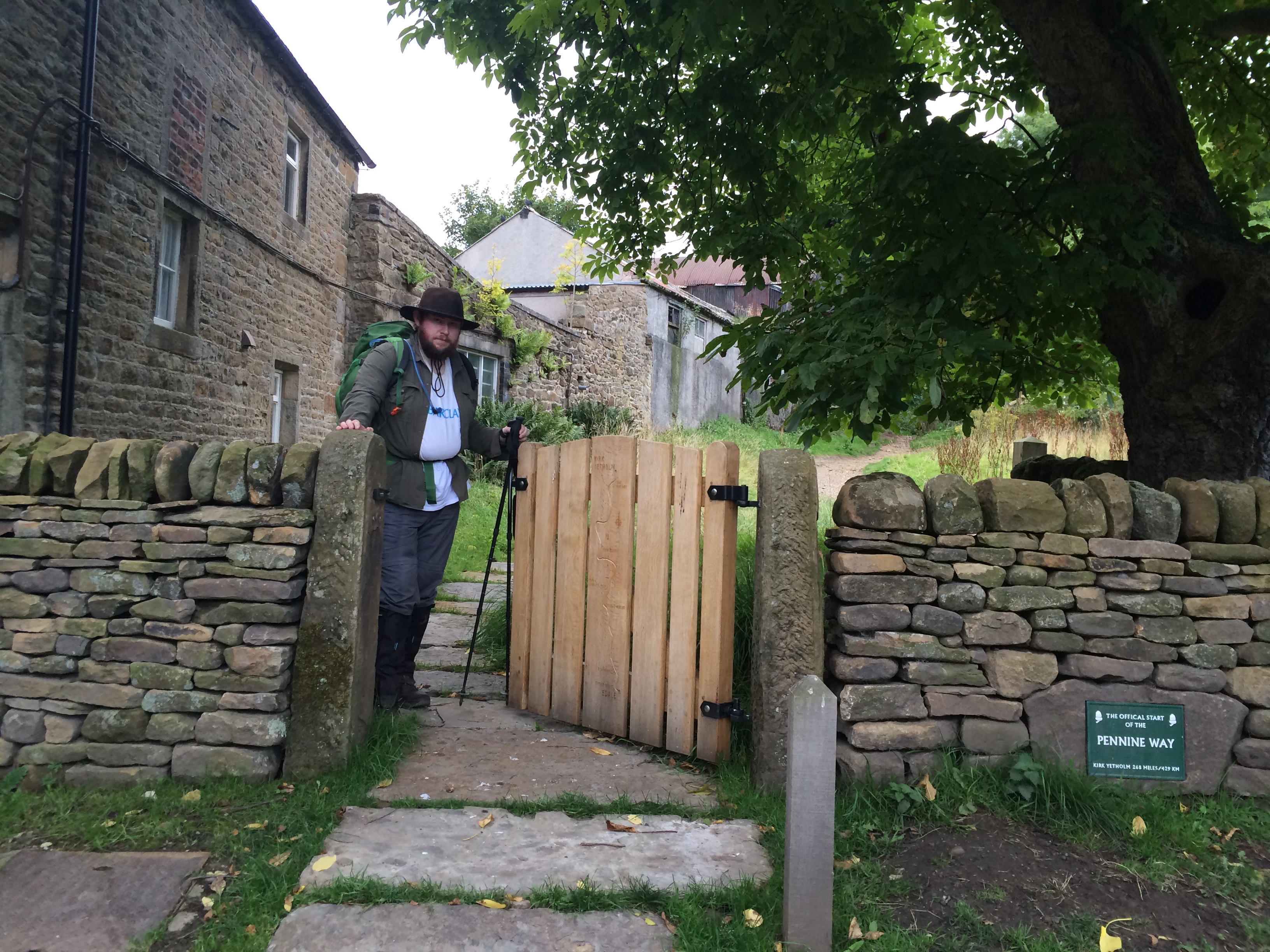
Arriving at the end was some relief. We had done it. I think my fathers ephiphany that Wainwright was infact simply a drunk who stumbled from pub to pub seemed rather apt as we drank our final pint and munched on our crisps before heading off to the station. When we set off I really did not expect that we should make it and I am confident that more preparation (especially on my father’s part) would have been a good investment. However, having said that we made it to the end and in only 18 days 10 hours 22 minutes and 13 seconds which I think is pretty good going really.
|
|
|
Does walking the Pennine Way look hard to you? Well why not sponsor me here.
